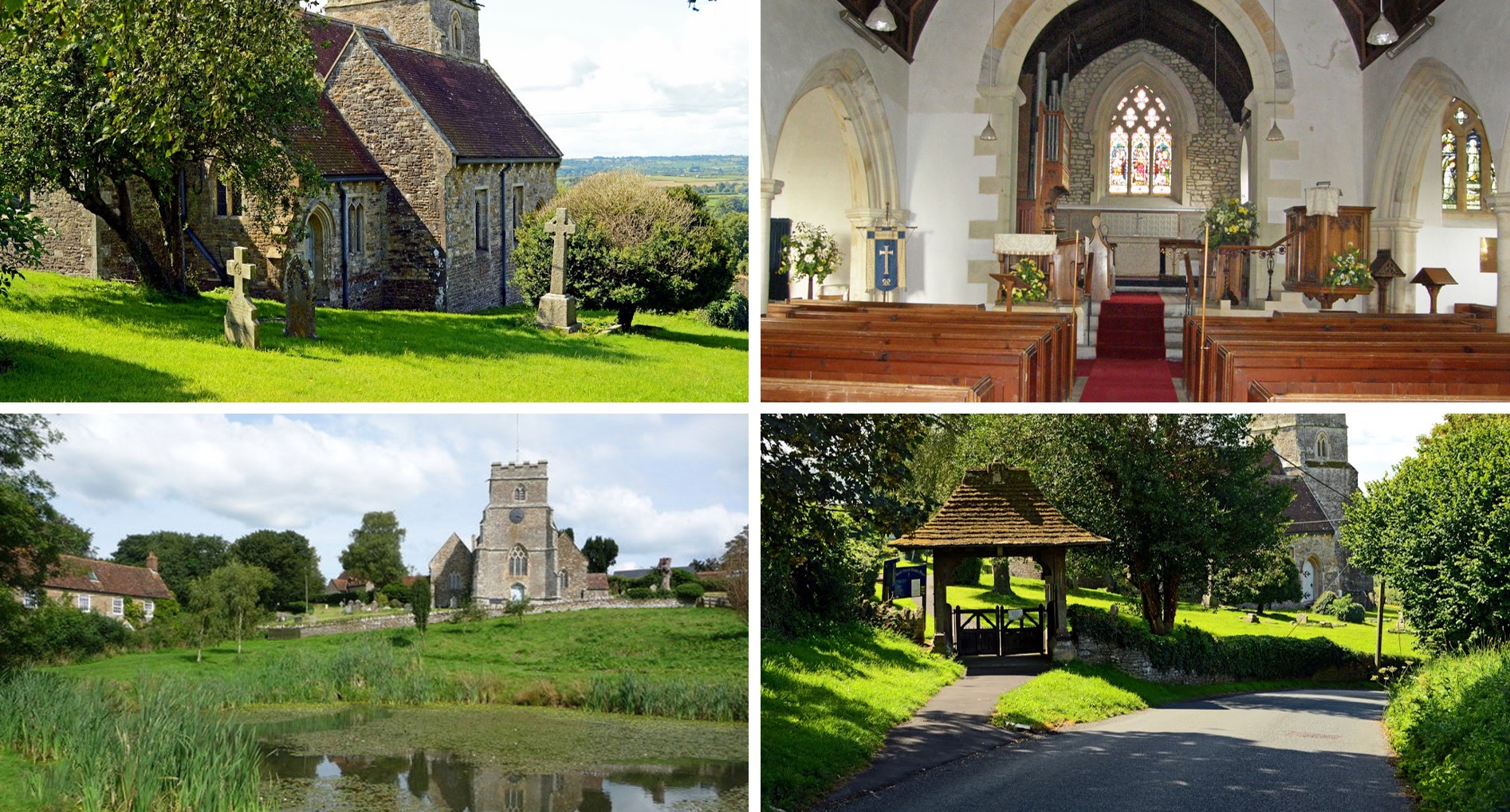
The Parish of Buckhorn Weston
Buckhorn Weston is a village and civil parish situated in the Blackmore Vale in the North Dorset administrative district, about 3 miles (4.8 kilometres) west of the town of Gillingham. It lies on the western edge of the former royal hunting ground of Gillingham Forest. The underlying geology is Oxford clay and Corallian limestone. In the 2011 census the civil parish had a population of 356.

In Saxon times the area was known as Bokere Waston, which meant ‘hamlet in the wilderness near the dyke’. Saxons invaded the area around 450 AD, driving out existing inhabitants and possibly erecting a heathen temple on the site of a previous place of worship. When the Saxons converted to Christianity in about 600 AD, they built a church to replace the temple.
In 1086 Buckhorn Weston was recorded in the Domesday Book as Westone; it had 26 households, 6 ploughlands and 40 acres (16 hectares) of meadow. It was in the Hundred of Gillingham and the tenant-in-chief was Count Robert of Mortain. In 1349 the village was badly affected by the plague and its population much reduced. Later, the estate passed via the Stourton family (associated with Stourhead) and the Fane family into the hands of the Stapleton family in 1837 who remained substantial local landowners until the death of Sir Miles Stapleton in 1979. The village inn still bears the family name and coat of arms. In celebration of the Millennium, the village was enabled to build a new village hall with the help of significant external funding.
The Parish church of St John the Baptist was well established by the beginning of the 13th century and has probably existed from earlier times. The present building dates largely from the 14th and 15th centuries, though in the 19th century much of it was significantly altered, which included the rebuilding of the west tower.
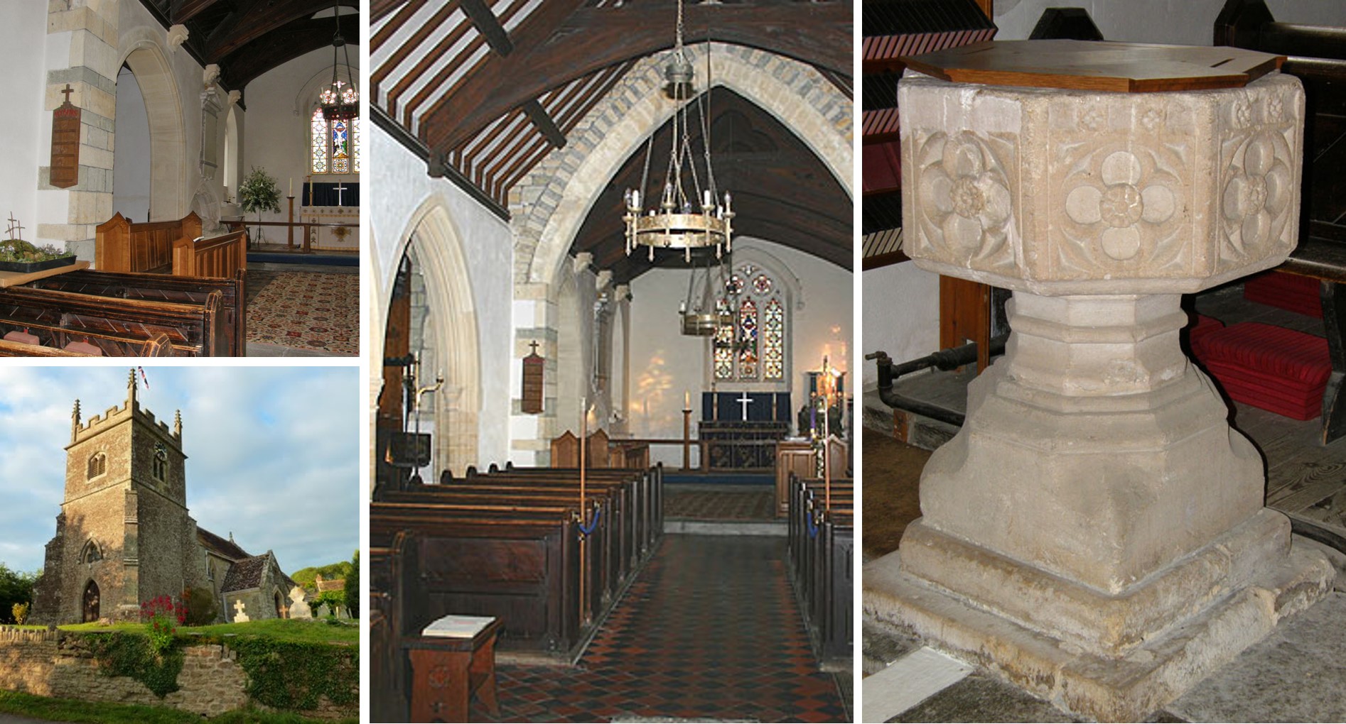
The Parish of Kington Magna
Kington Magna is a village and civil parish in the Blackmore Vale in the English county of Dorset, situated about 3.5 miles south-west of the town of Gillingham, in the North Dorset administrative district. In the 2011 census the parish had 180 dwellings, 169 households and a population of 389.
The parish covers about 2,000 acres (810 hectares) and, as well as the main village, includes the small settlement of Nyland in the west. The main village is sited on the slopes of a Corallian limestone hill, overlooking the flat Oxford Clay valley of the small River Cale, which drains into the Stour. In 1906 Sir Frederick Treves wrote in his Highways & Byways in Dorset that the village “straggles down hill like a small mountain stream.”

The name Kington Magna means ‘great King’s Town’; it derives from cyne- (later cyning) and tūn, Old English for ‘royal estate or manor’. The affix magna, Latin for great, was added to distinguish it from Little Kington, a smaller settlement nearby. In 1086 in the Domesday Book these were recorded together in three entries as Chintone, which had 27 households and a total taxable value of 13 geld units, and was in the Hundred of Gillingham. In 1243 it was recorded as Magna Kington although most of the current buildings in the village are no older than the seventeenth century. In 1851 a primitive Methodist chapel was built in the village on Chapel Hill, which runs parallel to Church Hill. In 1860 a pottery was established at Bye Farm, north of the main village; it manufactured tiles, drainpipes, bricks, and chimney and flower pots. The parish church of All Saints was restored and enlarged in 1862; most of the building, except for the late 15th-century west tower, was rebuilt. Near the church is a medieval fishpond.